Marzena Wicht (recipient of three LASmoons)
Department of Photogrammetry, Remote Sensing and GIS
Warsaw University of Technology, Poland.
Background:
More than half of human population (Heilig 2012) suffers from many negative effects of living in cities: increased air pollution, limited access to the green areas, Urban Heat Island (UHI) and many more. To mitigate some of these effects, many ideas came up over the years: reducing the surface albedo, the idea of the Garden City, green belts, and so on. Increasing horizontal wind speed might actually improve both, the air pollution dispersion and the thermal comfort in urban areas (Gál & Unger 2009). Areas of low roughness promote air flow – discharging the city from warm, polluted air and supplying it with cool and fresh air – if they share specific parameters, are connected and penetrate the inner city with a country breeze. That is why mapping low roughness urban areas is important in better understanding urban climate.
Goal:
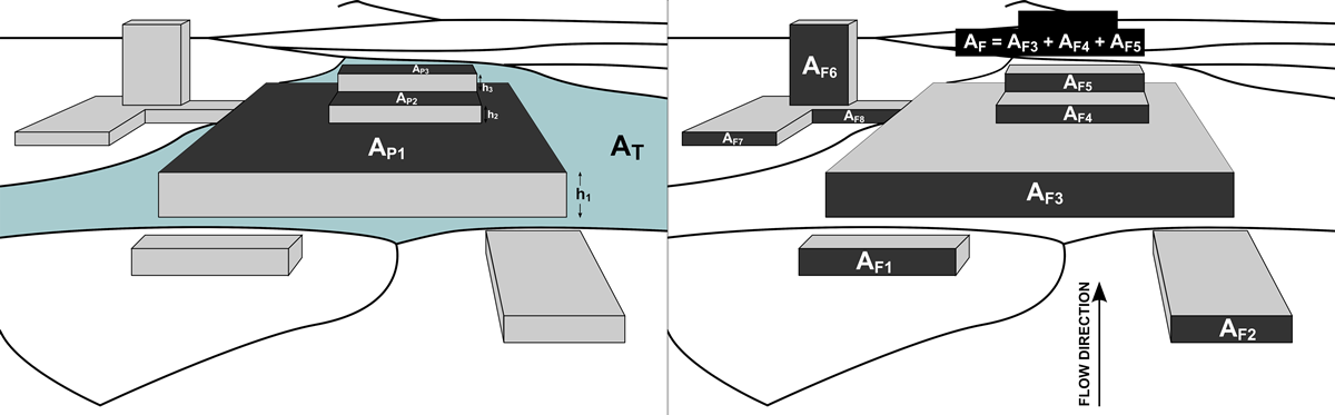
The goal of this study is to derive buildings (outlines and height) and high vegetation using LAStools and to use that data in mapping urban ventilation corridors for our case study area in Warsaw. There are many ways to map these; however using ALS data has certain advantages (Suder& Szymanowski 2014) in this case: DSMs can be easily derived, tree canopy (incl. height) can be joined to the analysis and buildings can be easily extracted. The outputs are then used as a basis for morphological analysis, like calculating frontal area index. LAStools has the considerable advantage of processing large quantities of data (~500 GB) efficiently.
Data:
+ LiDAR provided by Central Documentation Center of Geodesy and Cartography
+ average pulse density 12 p/m^2
+ covers 517 km^2 (whole Warsaw)
LAStools processing:
1) quality checking of the data as described in several videos and blog posts [lasinfo, lasvalidate, lasoverlap, lasgrid, lasduplicate, lasreturn, las2dem]
2) reorganize data into sufficiently small tiles with buffers to avoid edge artifacts [lastile]
3) classify point clouds into vegetation and buildings [lasground, lasclassify]
4) normalize LiDAR heights [lasheight]
5) create triangulated, rasterized derivatives: DSM / DTM / nDSM / CHM [las2dem, blast2dem]
6) compute height-based metrics (e.g. ‚-avg‘, ‚-std‘, and ‚-p 50‘) [lascanopy]
7) generate subsets during the workflow [lasclip]
8) generate building footprints [lasboundary]
References:
Heilig, G. K. (2012). World urbanization prospects: the 2011 revision. United Nations, Department of Economic and Social Affairs (DESA), Population Division, Population Estimates and Projections Section, New York.
Gal, T., & Unger, J. (2009). Detection of ventilation paths using high-resolution roughness parameter mapping in a large urban area. Building and Environment, 44(1), 198-206.
Suder, A., & Szymanowski, M. (2014). Determination of ventilation channels in urban area: A case study of Wroclaw (Poland). Pure and Applied Geophysics, 171(6), 965-975.