At the beginning of July 2018 the Baltic country of Estonia – with an area of 45 thousand square kilometers inhabited by around 1.3 million people – opened much of their geospatial data archives and is now offering easy and free download of LiDAR point clouds nationwide via a portal of the Estonian Land Board. What is even more exciting is that multi-temporal data sets flown in different years and seasons are available. Raw LiDAR point clouds collected either during a „regular flight in spring“ or during a „forestry flight in summer“ can be obtained for multiple years. The 1 km by 1 km tile with map sheet index 377650, for example, is available for four different LiDAR surveys carried out in spring 2011, summer 2013, spring 2015 and summer 2017. This offers incredible potential for studying temporal changes of man-made or natural environments. The screenshot sequence below shows how to navigate to the download site starting from this page.
We found out about this open data release during our hands-on workshop on LiDAR and photogrammetry point cloud processing with LAStools that was part of the UAV remote sensing summer school in Tartu, Estonia. See our calendar for upcoming events or contact us for holding a similar event at your university, agency, company, or conference.
The LiDAR data provided on the download portal is compressed with LASzip and provided as 1km by 1km LiDAR tiles in LAZ format. You can search for these tiles via their Estonian 1:2000 map sheet indices. To find out which map sheet index corresponds to the tile you are interested in you can overlay the maps sheet indices over an online map. However, you will need to zoom in before you can see the indices as illustrated in the screenshot sequence below. Here a zoom to the map sheet indices for the area that we visited during the social event of the summer school.
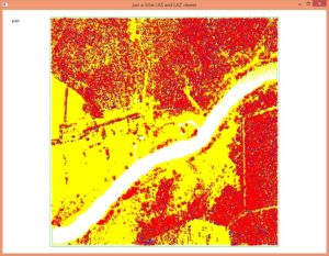
One thing we noticed is that the tiles contain only a single layer of points. The overlaps between flightlines were removed which results in a more uniform point density but strips the user of the possibility to do their own flightline alignment checks with lasoverlap. Below you see the spring 2014 acquisition for the tile with map sheet index 475861 colored by classification, elevation, return type, flightline ID and intensity.
The license for the open data of the Estonian Land Board is very permissive and can be found here. Agreeing to the licence gives the licence holder the rights to use data free of charge for an unspecified term, to good purpose in accordance with law and best practice. Licence holder may produce derivatives of data, combine data with its own products or services, use data for commercial or non-commercial purposes and redistribute data. The licence holder obliges to refer to the origin of data when publishing and redistributing data. The reference must include the name of the licensor, the title of data, the age of data (or the date of data extraction).


Pingback: Using Open LiDAR to Remove Low Noise from Photogrammetric UAV Point Clouds | rapidlasso GmbH