Asanga Ramanayake (recipient of three LASmoons)
BGSU Remote Sensing Lab, School of Earth, Environment and Society
Bowling Green State University, Ohio, USA
Background:
Lake Erie is the Southern most of the Great Lakes and it is shared by 4 states and 2 countries. It is the shallowest, warmest, and most biologically productive of all the Great Lakes. At wetland habitats along the Western Lake Erie coast, more than 300 species of plants have been identified. To study land use and to classify vegetation cover it is important to consider the vertical distribution of the vegetation. LiDAR is an active data collection system for generating 3D spatial information of objects. High-resolution Digital Terrain Models (DTMs) and Digital Surface Models (DSMs) can be generated from the available LiDAR points that allow accurate estimates of canopy height.
Goal:
The main goal of this project is to derive Digital Terrain Models (DTMs) and Digital Surface Models (DSMs) for the coastal areas of Lake Erie using LIDAR data to estimate the height of the canopy. The derived products will be validated with in-situ measurements from other researchers and compared with ASTER Global Digital Elevation Model data.
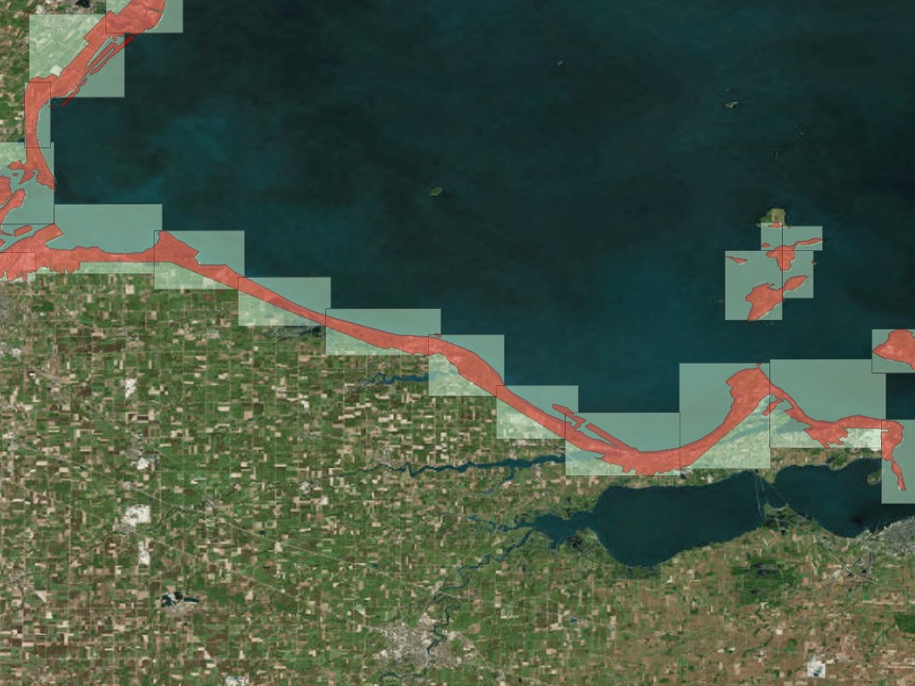
Data:
+ The Ohio Geographically Referenced Information Program (OGRIP) has free downloadable LIDAR data in LAS format that was acquired by Ohio Statewide Imagery Program (OSIP) in 2006-2008.
+ In 2011-2012 NOAA’s mission was capturing coastal area LiDAR data. This data is served to the public and available in LAZ format.
LAStools processing:
1) create square tiles to avoid edge artifacts [lastile]
2) classify point clouds into ground and non-ground [lasground]
3) generate DTMs and DSMs for the coastal areas of Lake Erie [las2dem]
4).produce height normalized tiles [lasheight]
5) generate a Canopy Height Model (CHM) using the pit-free method of Khosravipour et al. (2014) [lasthin, las2dem, lasgrid]
Reference:
Herdendorf, Charles E. The ecology of the coastal marshes of western Lake Erie: a community profile. OHIO STATE UNIV COLUMBUS, 1987.
Deems, Jeffrey S., Thomas H. Painter, and David C. Finnegan. “Lidar Measurement of Snow Depth: A Review.” Journal of Glaciology 59.215 (2013): 467–479. IngentaConnect. Web.
Jensen, John R. Remote Sensing of the Environment: An Earth Resource Perspective. 2nd ed. Upper Saddle River, NJ: Pearson Prentice Hall, 2007. Print. Prentice Hall Series in Geographic Information Science.
Khosravipour, A., Skidmore, A.K., Isenburg, M., Wang, T.J., Hussin, Y.A., 2014. Generating pit-free Canopy Height Models from Airborne LiDAR. PE&RS = Photogrammetric Engineering and Remote Sensing 80, 863-872.