Chloe Brown (recipient of three LASmoons)
Geosciences, School of Geography
University of Nottingham, UK
Background:
Malaysia’s North Selangor peat swamp forest is experiencing rapid and large scale conversion of peat swampland to oil palm agriculture, contrary to prevailing environmental guidelines. Given the global importance of tropical peat lands, and the uncertainties surrounding historical and future oil palm development, quantifying the spatial distribution of ecosystem service values, such as climate mitigation, is key to understanding the trade-offs associated with anthropogenic land use change.
The study explores the capabilities and methods of remote sensing and field-based data sets for extracting relevant metrics for the assessment of carbon stocks held in North Selangor peat swamp forest reserve, estimating both the current carbon stored in the above and below ground biomass, as well as the changes in carbon stock over time driven by anthropogenic land use change. Project findings will feed directly into peat land management practices and environmental accounting in Malaysia through the Tropical Catchments Research Initiative (TROCARI), and support the Integrated Management Plan of the Selangor State Forest Department (see here for a sample).
Goal:
LiDAR data is now seen as the practical option when assessing canopy height over large scales (Fassnacht et al., 2014), with Lucas et al., (2008) believing LiDAR data to produce more accurate tree height estimates than those derived from manual field based methods. At this stage of the project, the goal is to produce a high quality LiDAR-derived Canopy Height Model (CHM) following the “pit-free” algorithm of Khosravipour et.al., 2014 using the LAStools software.
Data:
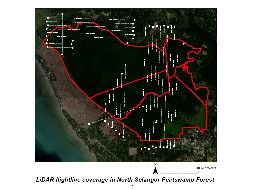
+ LiDAR provided by the Natural Environment Research Council (NERC) Airborne Research and Survey Facility’s 2014 Malaysia Campaign.
+ covers 685 square kilometers (closed source)
+ collected with Leica ALS50-II LiDAR system
+ average pulse spacing < 1 meter, average pulse density 1.8 per square meter
LAStools processing:
1) Create 1000 meter tiles with 35 meter buffer to avoid edge artifacts [lastile]
2) Remove noise points (class 7) that are already classified [las2las]
3) Classify point clouds into ground (class 2) and non-ground (class 1) [lasground]
4) Generate normalized above-ground heights [lasheight]
5) Create DSM and DTM [las2dem]
6) Generate a pit-free Canopy Height Model (CHM) as described here [lasthin, las2dem, lasgrid]
7) Generate a spike-free Canopy Height Model (CHM) as described here for comparison [las2dem]
References:
Fassnacht, F.E., Hartig, F., Latifi, H., Berger, C., Hernández, J., Corvalán, and P., Koch, B. (2014). Importance of sample size, data type and prediction method for remote sensing-based estimations of above-ground forest biomass. Remote Sensing. Environment. 154, 102–114.
Khosravipour, A., Skidmore, A. K., Isenburg, M., Wang, T., and Hussin, Y. A. (2014). Generating pit-free canopy height models from airborne LiDAR. Photogrammetric Engineering & Remote Sensing, 80(9), 863-872.
Lucas, R. M., Lee, A. C., and Bunting, P. J., (2008). Retrieving forest biomass through integration of casi and lidar data. International Journal of Remote Sensing, 29 (5), 1553-1577.