Elia Palop-Navarro (recipient of three LASmoons)
Research Unit in Biodiversity (UO-PA-CSIC)
University of Oviedo, SPAIN.
Background:
Old-growth forests play an important role in biodiversity conservation. However, long history of human transformation of the landscape has led to the existence of few such forests nowadays. Its structure, characterized by multiple tree species and ages, old trees and abundant deadwood, is particularly sensible to management practices (Paillet et al. 2015) and requires long time to recover from disturbance (Burrascano et al. 2013). Within protected areas we would expect higher proportions of old-growth forests since these areas are in principle managed to ensure conservation of natural ecosystems and processes. Nevertheless, most protected areas in the EU sustained use and exploitation in the past, or even still do.
Goal:
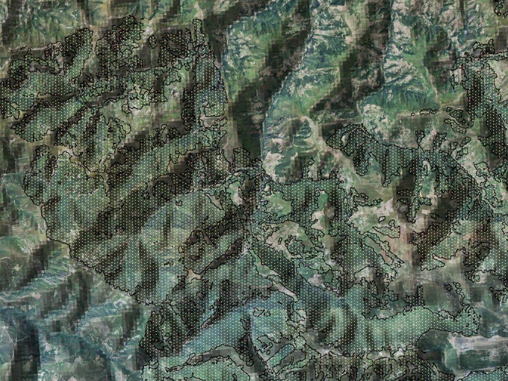
Through the application of a model developed in the study area, using public LiDAR and forest inventory data (Palop-Navarro et al. 2016), we’d like to know how much of the forest in a network of mountain protected areas retains structural attributes compatible with old-growth forests. The LiDAR processing tasks which LAStools will be used for involve a total of 614,808 plots in which we have to derive height metrics, such as mean or median canopy height and its variability.
Data:
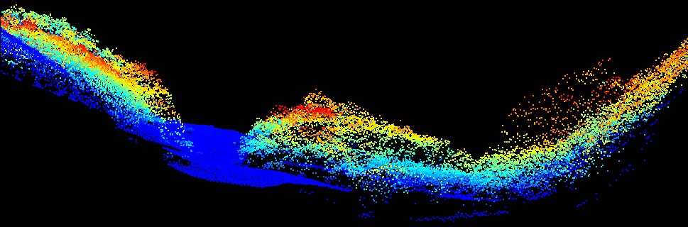
+ Public LiDAR data that can be downloaded here with mean pulse density 0.5 points per square meter. This data has up to 5 returns and is already classified into ground, low, mid or high vegetation, building, noise or overlapped.
+ The area covers forested areas within protected areas in Cantabrian Mountains, occupying 1,207 km2.
LAStools processing:
1) quality checking of the data as described in several videos and blog posts [lasinfo, lasvalidate, lasoverlap, lasgrid, las2dem]
2) use existing ground classification (if quality suffices) to normalize the elevations of to heights above ground using tile-based processing with on-the-fly buffers of 50 meters to avoid edge artifacts [lasheight]
3) compute height-based forestry metrics (e.g. ‚-avg‘, ‚-std‘, and ‚-p 50‘) for each plot in the study area [lascanopy]
References:
Burrascano, S., Keeton, W.S., Sabatini, F.M., Blasi, C. 2013. Commonality and variability in the structural attributes of moist temperate old-growth forests: a global review. Forest Ecology and Management 291:458-479.
Paillet, Y., Pernot, C., Boulanger, V., Debaive, N., Fuhr, M., Gilg, O., Gosselin, F. 2015. Quantifying the recovery of old-growth attributes in forest reserves: A first reference for France. Forest Ecology and Management 346:51-64.
Palop-Navarro, E., Bañuelos, M.J., Quevedo, M. 2016. Combinando datos lidar e inventario forestal para identificar estados avanzados de desarrollo en bosques caducifolios. Ecosistemas 25(3):35-42.