This article is obsolete. Please see New Plugin: LAStools for ArcGIS Pro
In what some may call a „good LAZ, bad zLAS“ routine, rapidlasso GmbH announces better integration of their LiDAR processing technology into ESRI’s ArcGIS platform with new and improved LAStools toolboxes. This comes merely two days after pranking ESRI with an April Fools‘ Day press release that was cheered on by a user community that is growing increasingly tired of ESRI bulldozing their own path instead of working together with them.
The new „LAStools Production“ toolbox allows to batch automated LiDAR processing tasks across folders of LAS or LAZ files, which is a necessity for production workflows dealing with the Terabytes of LiDAR data involved in typical real-world projects. The new toolbox allows advanced users to further customize processing with an option for providing „additional command line parameters“. This capability has also been added to the good old LAStools toolbox, which is the better choice when operating on only a single LAS or LAZ file at a time.

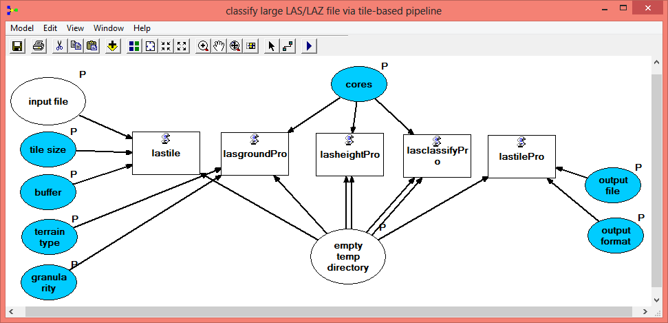
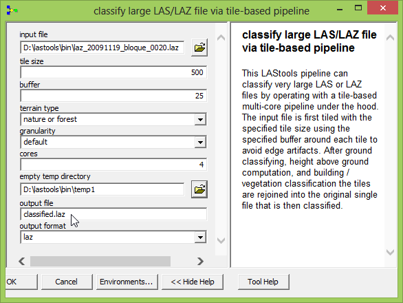
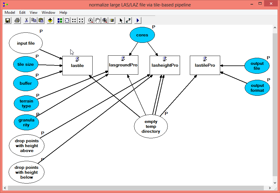
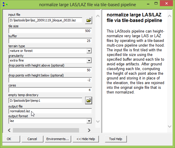
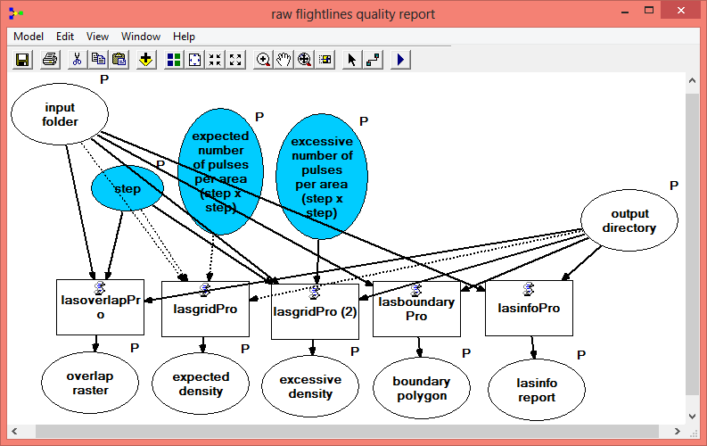
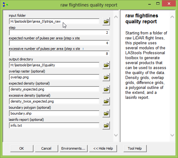
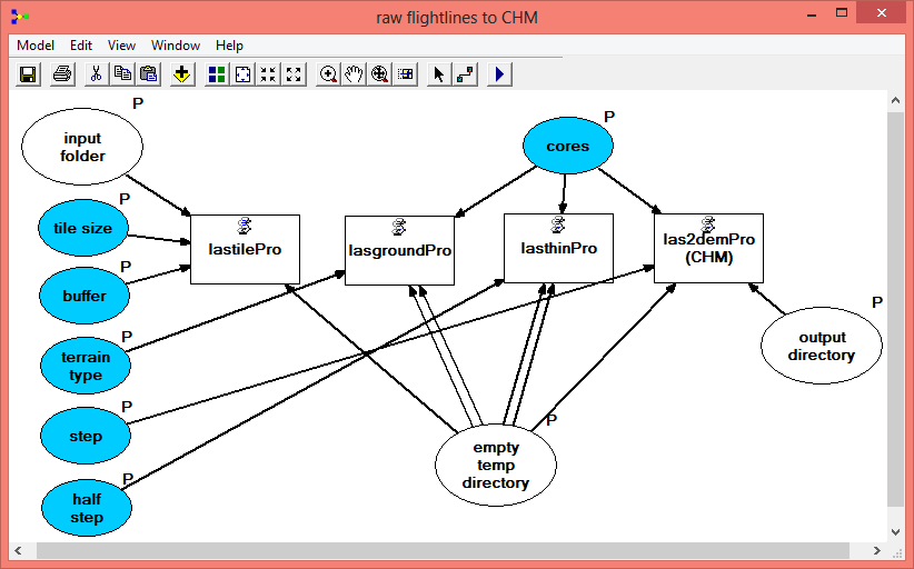
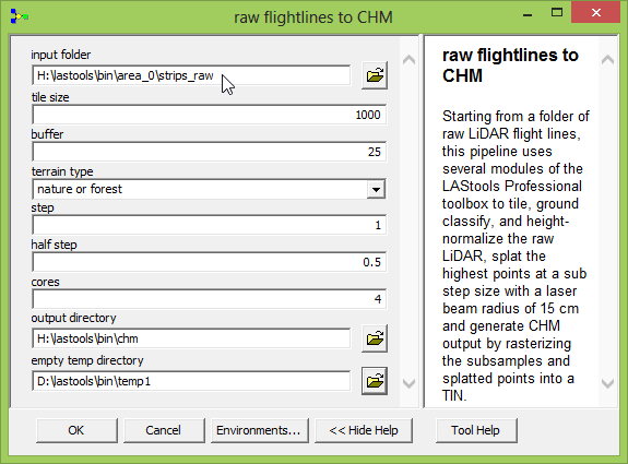
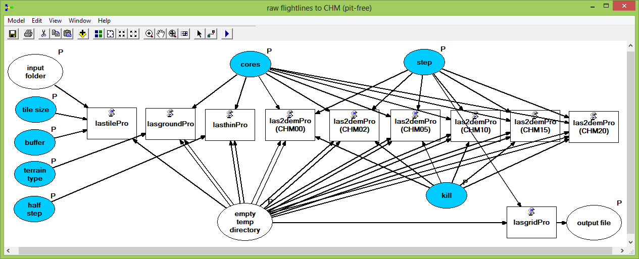
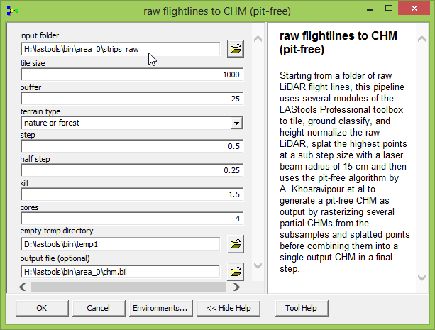
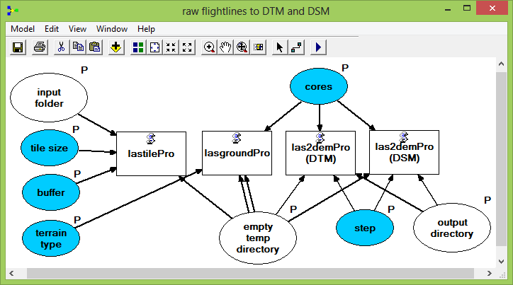
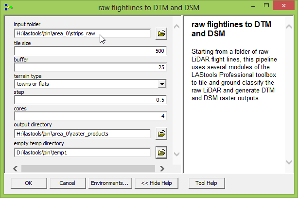
Built-upon the „LAStools Production“ toolbox are some example „LAStools Pipelines“ using the ArcGIS Model Builder that combine the new production tools to batch process entire folders worth of raw LiDAR flightlines into final products. Advanced users may find it more elegant to use Python scripting to combine the batch processing modules from the „LAStools Production“ toolbox into more complex workflows. The „LAStools Pipelines“ shown below were created in ArcGIS 9.3 and can be downloaded as part of the LAStools distribution (20 MB). Some LAStools Pipelines may not load due to incompatibilities between different versions of ESRI’s ArcGIS Model Builder. Please contribute your own pipelines or share modifications that work for other versions of ArcGIS. Below some screen shots of the six „LAStools Pipelines“ that are included as an example in today’s release of LAStools (version 140403). One of them implements the algorithm for constructing „pit-free“ CHMs that was presented by Khosravipour et. al at Silvilaser 2013 (find poster and abstract here).
Pingback: ArcGIS LAStools toolbox for LiDAR processing | rapidlasso GmbH
Pingback: ArcGIS toolbox – rapidlasso GmbH