Andreas Konring and Susanne Bjerg Petersen (recipients of three LASmoons)
Department of Environmental Engineering
Technical University of Denmark, Lyngby, DENMARK
Background:
Copenhagen has in the recent years experienced severe floodings due to cloudbursts which has increased the focus of climate adaption and the implementation of green infrastructure. The use of sustainable urban drainage system (SUDS) solutions to divert stormwater from the existing drainage system will be a central measure to increase the climate resilience while greenifying the city and Copenhagen municipality is investing 700 million euros in SUDS projects alone. Additionally, the city has decided to plant 100.000 new trees in the next 10 years as another measure to enhance natural amenities but also because of air cleansing and cooling effects. However, it has not been investigated what effect the current canopy cover has on the rainwater retention due to increased evaporation and soil infiltration and if planting more trees could help improve the pluvial flooding issues.
Goal:
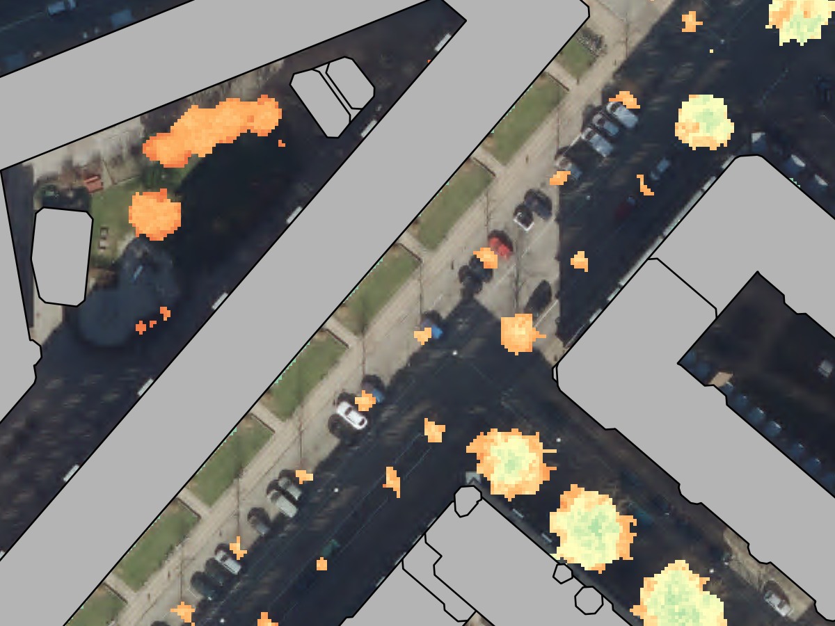
This study aims to estimate the current number of trees and extract tree metrics such as volume, canopy cover and densities with the use of the national LIDAR dataset and NIR ortophotos from summer and spring. These canopy metrics will be used to inform a simple tree model which will be implemented in a 2-D overland flow model to assess the effect of trees on flood mitigation. The created CHM could also be used in further analysis of the urban heat island effect.
Data:
+ 100 square kilometers of the Danish national LiDAR dataset collected in November 2014 covering the municipality of Copenhagen.
+ density of 4 – 5 last-returns per square meter
+ classified into surface (1), ground (2), vegetation (3,4,5), buildings (6), noise (7) and water (9).
LAStools processing:
1) create square tiles with buffer to avoid edge artifacts [lastile]
2) generate DTMs and DSMs with only buildings and terrain [las2dem]
3).normalize height, remove outliers and keep classes 2, 5 and 6 [lasheight]
4) create rasters with forest metrics [lascanopy]
5) calculate the pit-free Canopy Height Model (CHM) proposed by Khosravipour et al. (2014) [lasthin, las2dem, lasgrid]
Reference:
Copenhagen Municipality, 2011. Copenhagen Climate Adaption Plan.
Geodatastyrelsen, 2014. Danmarks højdemodel, DHM/Punktsky – Dataversion 2.0 januar 2015. Product specification.
Khosravipour, A., Skidmore, A.K., Isenburg, M., Wang, T.J., Hussin, Y.A., 2014. Generating pit-free Canopy Height Models from Airborne LiDAR. PE&RS = Photogrammetric Engineering and Remote Sensing 80, 863-872.