Rachel Opitz (recipient of three LASmoons)
Center for Virtualization and Applied Spatial Technologies
Department of Anthropology, University of South Florida, USA
Background:
In Spring 2017 Rachel Opitz will be teaching a course on Remote Sensing for Human Ecology and Archaeology at the University of South Florida. The aim of the course is to provide students with the practical skills and knowledge needed to work with contemporary remote sensing data. The course focuses on airborne laser scanning and hyper-spectral data and their application in Human Ecology and Archaeology. Through the course students will be introduced to a number of software packages commonly used to process and interpret these data, with an emphasis on free and/or open source tools.
Goal:
The students will develop practical skills in applied remote sensing through hands-on exercises. Learning to assess, manage and process large data sets is essential. In particular, the students in the course will learn to:
+ Identify the set of techniques needed to solve a problem in applied remote sensing
+ Find public imagery and specify acquisitions
+ Assess data quality
+ Process airborne LiDAR data
+ Combine complementary remote sensing data sources
+ Create effective data visualizations
+ Analyze digital topographic and spectral data to answer questions in human ecology and archaeology
Data:
The course will include case studies that draw on a variety of publicly available data sets that will all be used in the exercises:
+ the PNOA data from Spain
+ data held by NOAA
+ data collected using NASA’s GLiHT platform
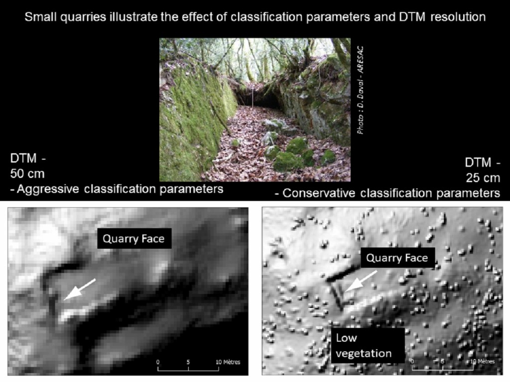
LAStools processing:
LAStools will be used throughout the course, as students learn to assess the quality of LiDAR data, classify raw LiDAR point clouds, create raster terrain and canopy models, and produce visualizations. The online tutorials and videos available via the company website and the over 50 hours of video on YouTube as well as the LAStools user forum will be used as resources during the course.
Link to course registration information?
It’s a course offered at University of South Florida. Ask Rachel Optiz of USF how to enroll.